
SF Port: Waterfront Plan Land Use Update
The SF Port led a public planning process to update the Waterfront Plan, which produced recommendations to assist Port and City efforts to preserve maritime industry, open more piers to the public, activate parks, plan for sea level rise, and improve transportation. The Planning Department assisted in providing expertise in knowledge of Complete Streets and the public realm. (2018)
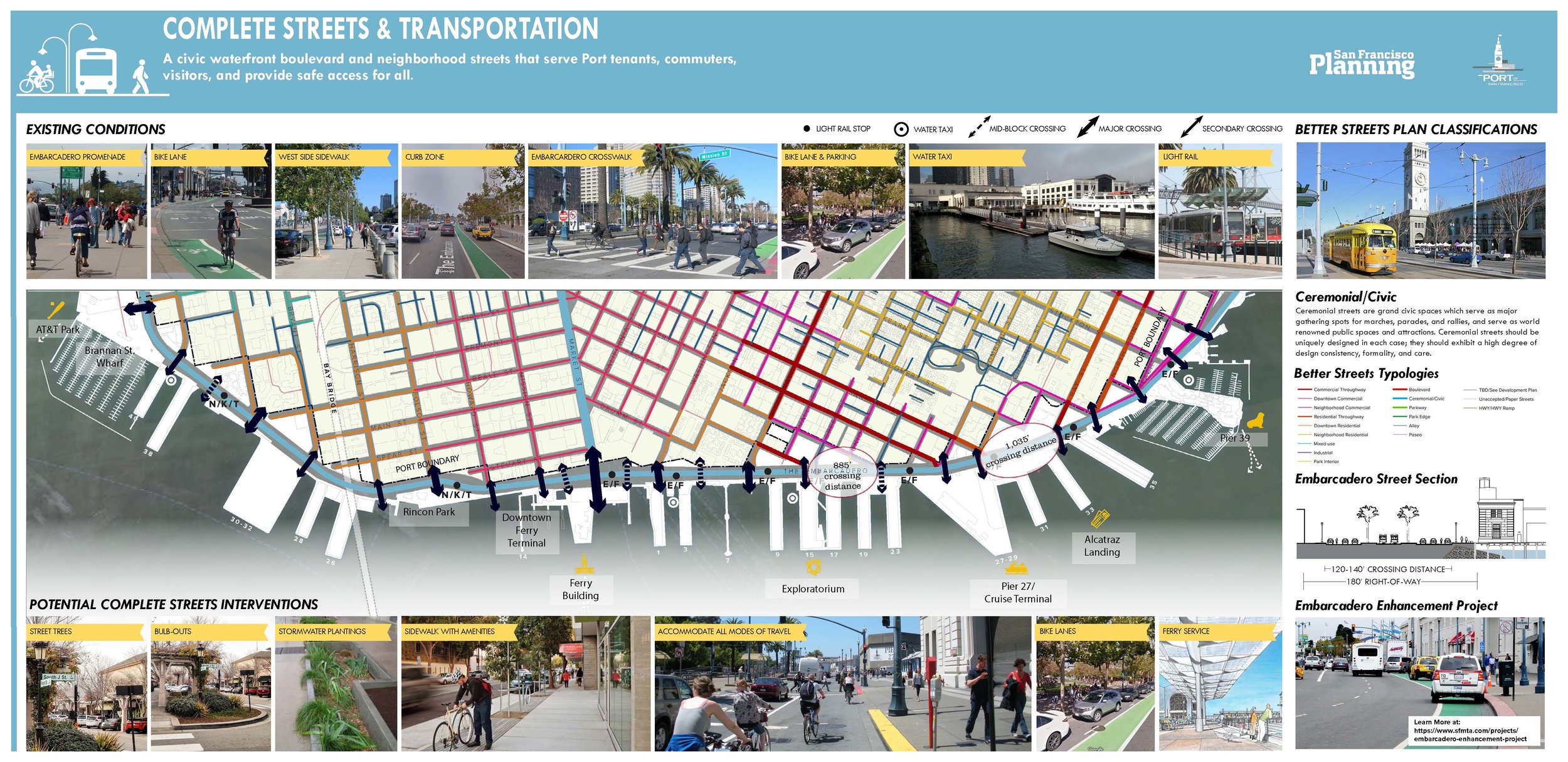
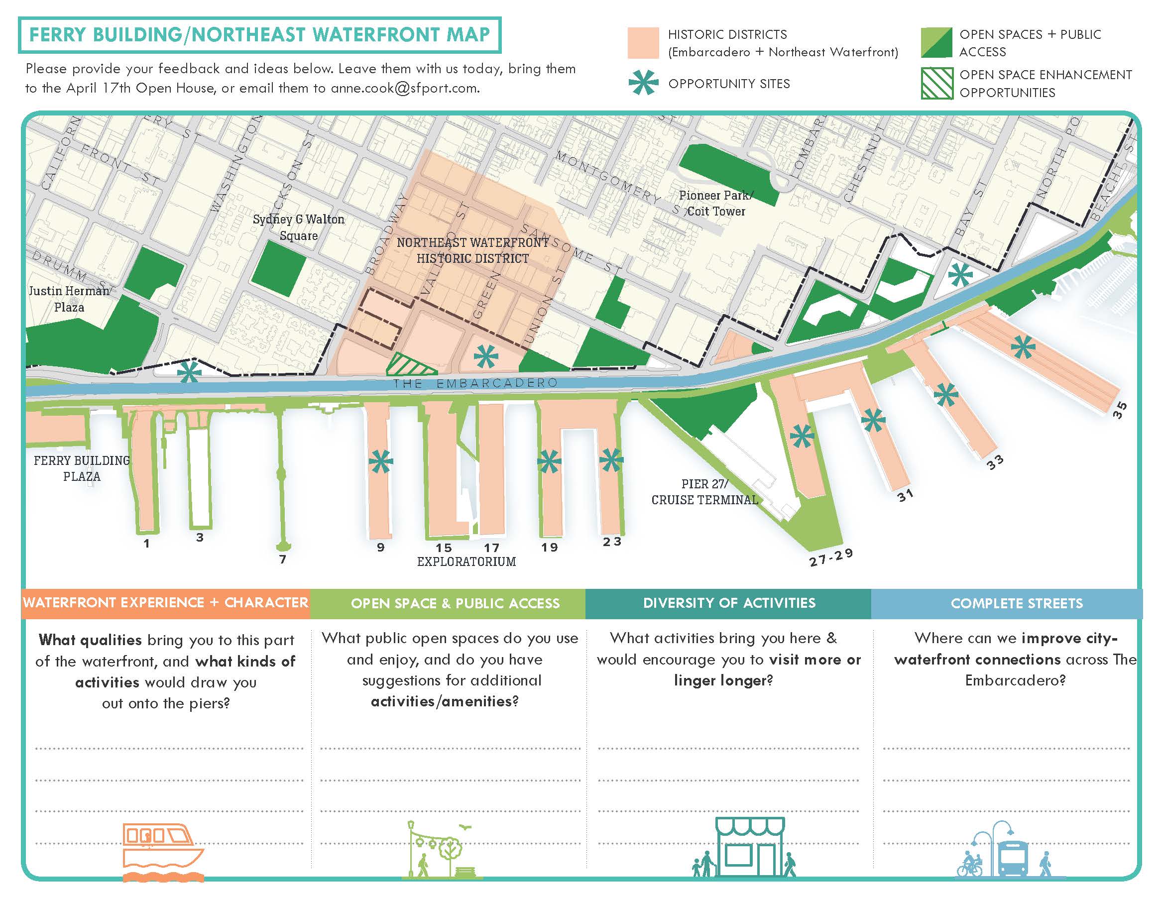
Role: Coordinate SF Port & SF Planning teams, communicate between agencies, provide expertise in Complete Streets topics and the Public Realm, create graphics for workshops, walk shops, handouts, and flyers. (SF Planning)