
Southeast Framework: Community Facilities
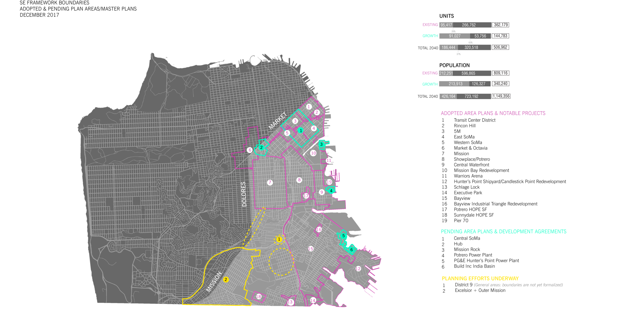
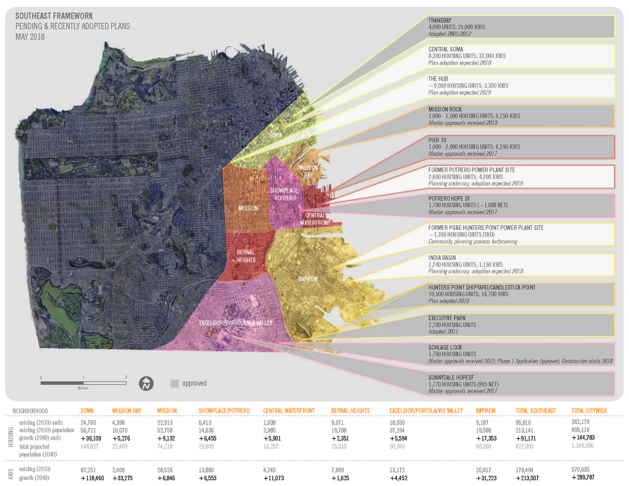
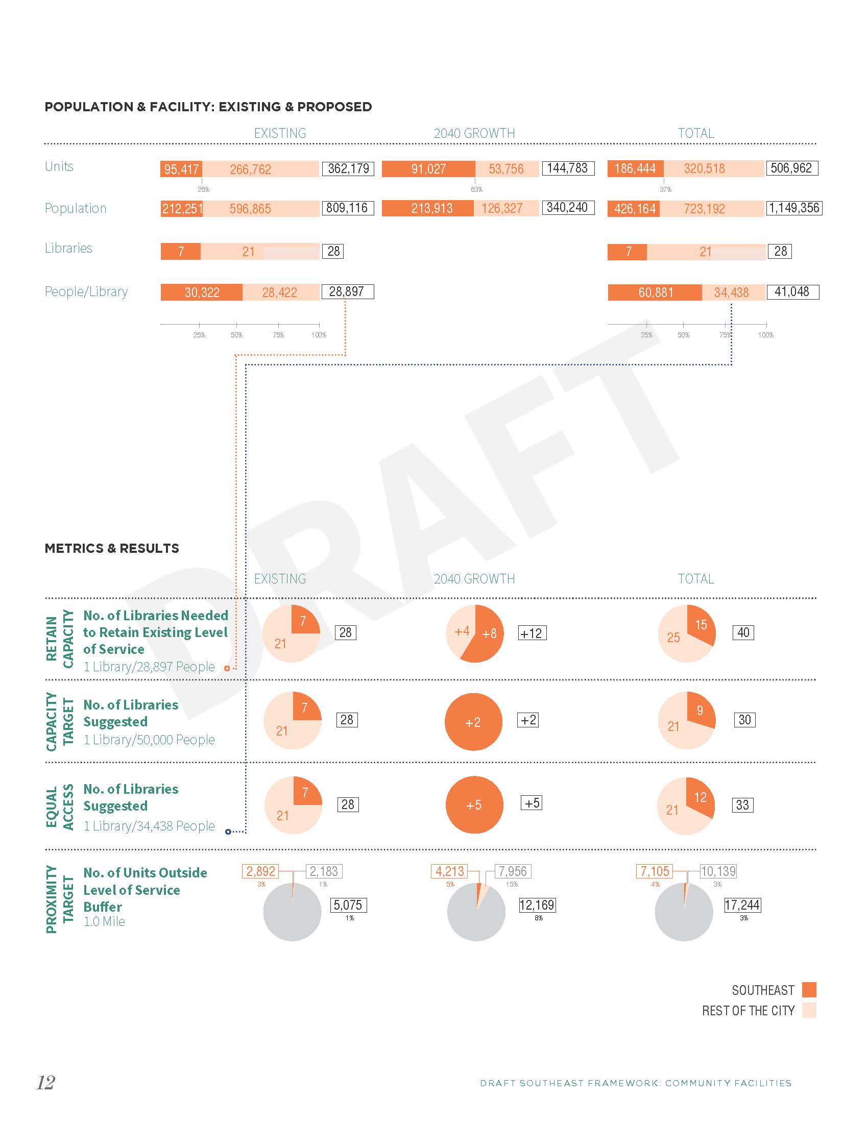
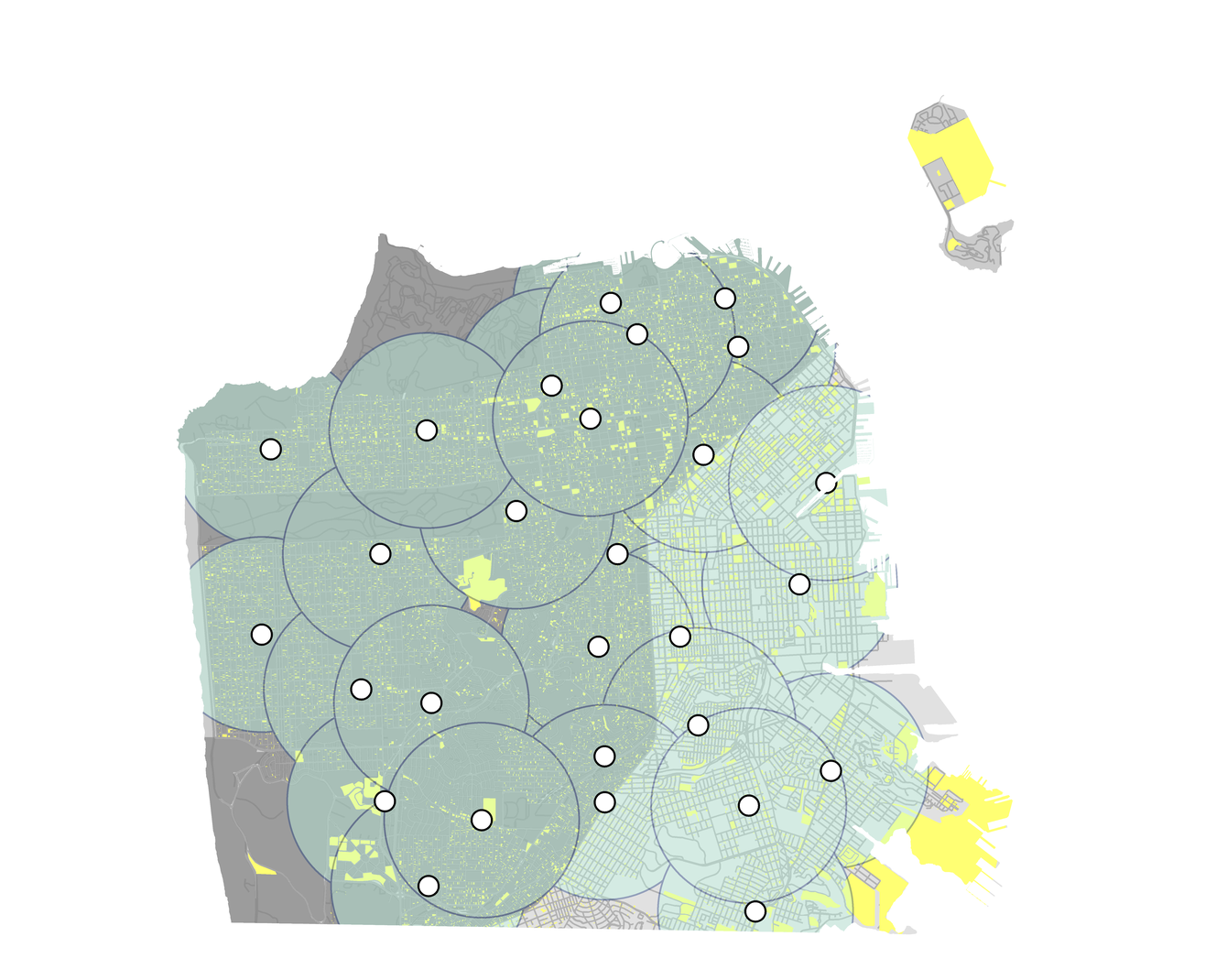
The southeast area of San Francisco is seeing incredible amounts of change in the coming years. While there are many area plans in this geographic area of the city, this effort focuses on a cohesive analysis of the service levels of each community facility (Fire, Police, Library, Education, Childcare, Public Health, Grocery) to assist in growth capacity planning under different service and population scenarios. (2015 - 2018)
Role: Lead planner, background research, GIS analysis, document assembly, graphic support.